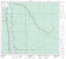
Maps showing Willow Island, 91-9-W4, Alberta
Willow Island is a Island located in 91-9-W4, Alberta and has an elevation of 240 meters.
- Latitude: 56° 52' 6'' North (decimal: 56.8683332)
- Longitude: 111° 25' 48'' West (decimal: -111.4299999)
- Topography Feature Category: Island
- Geographical Feature: Island
- Canadian Province/Territory: Alberta
- Elevation: 240 meters
- Location: 91-9-W4
- Atlas of Canada Locator Map: Willow Island
- GPS Coordinate Locator Map: Willow Island Lat/Long
Willow Island NTS Map Sheets