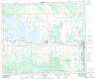
Maps showing Junkins, Alberta
Junkins is a Village located in Alberta.
- Latitude: 53° 37' North (decimal: 53.6167000)
- Longitude: 115° 14' West (decimal: -115.2333000)
- Topography Feature Category: Village
- Geographical Feature: Village
- Canadian Province/Territory: Alberta
- GPS Coordinate Locator Map: Junkins Lat/Long
Junkins NTS Map Sheets