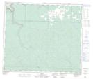
Maps showing Wilson Lake, 68-7-W6, Alberta
Wilson Lake is a Lake located in 68-7-W6, Alberta and has an elevation of 711 meters.
- Latitude: 54° 55' 32'' North (decimal: 54.9255555)
- Longitude: 119° 2' 53'' West (decimal: -119.0480556)
- Topography Feature Category: Lake
- Geographical Feature: Lake
- Canadian Province/Territory: Alberta
- Elevation: 711 meters
- Location: 68-7-W6
- Atlas of Canada Locator Map: Wilson Lake
- GPS Coordinate Locator Map: Wilson Lake Lat/Long