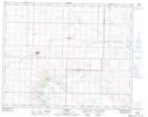
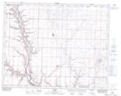
Maps showing Wolf Creek, 31-15-W4, Alberta
Wolf Creek is a River located in 31-15-W4, Alberta and has an elevation of 816 meters.
- Latitude: 51° 42' 26'' North (decimal: 51.7072222)
- Longitude: 112° 2' 57'' West (decimal: -112.0491667)
- Topography Feature Category: River
- Geographical Feature: Creek
- Canadian Province/Territory: Alberta
- Elevation: 816 meters
- Location: 31-15-W4
- Atlas of Canada Locator Map: Wolf Creek
- GPS Coordinate Locator Map: Wolf Creek Lat/Long
Wolf Creek NTS Map Sheets