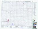
Maps showing Dawson Lake, 14,15-25-25-W4, Alberta
Dawson Lake is a Lake located in 14,15-25-25-W4, Alberta and has an elevation of 914 meters.
- Latitude: 51° 8' 5'' North (decimal: 51.1347221)
- Longitude: 113° 23' 40'' West (decimal: -113.3944444)
- Topography Feature Category: Lake
- Geographical Feature: Lake
- Canadian Province/Territory: Alberta
- Elevation: 914 meters
- Location: 14,15-25-25-W4
- Atlas of Canada Locator Map: Dawson Lake
- GPS Coordinate Locator Map: Dawson Lake Lat/Long
Dawson Lake NTS Map Sheets