Canada Topographic Maps

Deadhorse Coulee Topo Maps

Topography maps and Latitude/Longitude Location

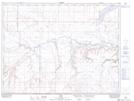
Maps showing Deadhorse Coulee, Alberta

Deadhorse Coulee is a Valley located in Alberta.

  • Latitude: 49° 5' North   (decimal: 49.0832999)
  • Longitude: 111° 28' West   (decimal: -111.4667000)
  • Topography Feature Category: Valley
  • Geographical Feature: Coulee
  • Canadian Province/Territory: Alberta
  • GPS Coordinate Locator Map: Deadhorse Coulee Lat/Long

Deadhorse Coulee NTS Map Sheets

072E03 Aden Topographic Map at 1:50,000 scale

072E Foremost Topographic Map at 1:250,000 scale

 
Buy Topographic Maps DVD
Newsletter Sign-up

Yes, I want to receive map store discounts.


Bookmark and Share