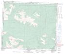
Maps showing Kakwa Falls, 59-13-W6, Alberta
Kakwa Falls is a Falls located in 59-13-W6, Alberta and has an elevation of 1408 meters.
- Latitude: 54° 6' 40'' North (decimal: 54.1111111)
- Longitude: 119° 55' 41'' West (decimal: -119.9280556)
- Topography Feature Category: Falls
- Geographical Feature: Falls
- Canadian Province/Territory: Alberta
- Elevation: 1408 meters
- Location: 59-13-W6
- Atlas of Canada Locator Map: Kakwa Falls
- GPS Coordinate Locator Map: Kakwa Falls Lat/Long