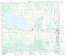
Maps showing Northville, 17-39-7-W5, Alberta
Northville is a Unincorporated area located in 17-39-7-W5, Alberta and has an elevation of 802 meters.
- Latitude: 53° 37' North (decimal: 53.6167000)
- Longitude: 115° 21' West (decimal: -115.3499999)
- Topography Feature Category: Unincorporated area
- Geographical Feature: Former Post Office
- Canadian Province/Territory: Alberta
- Elevation: 802 meters
- Location: 17-39-7-W5
- Atlas of Canada Locator Map: Northville
- GPS Coordinate Locator Map: Northville Lat/Long
Northville NTS Map Sheets