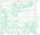
Maps showing Aggie, 36-74-18-W5, Alberta
Aggie is a Unincorporated area located in 36-74-18-W5, Alberta.
- Latitude: 55° 27' 5'' North (decimal: 55.4513889)
- Longitude: 116° 38' 30'' West (decimal: -116.6416667)
- Topography Feature Category: Unincorporated area
- Geographical Feature: Locality
- Canadian Province/Territory: Alberta
- Location: 36-74-18-W5
- Atlas of Canada Locator Map: Aggie
- GPS Coordinate Locator Map: Aggie Lat/Long