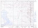
Maps showing Pakowki, 12-6-8-W4, Alberta
Pakowki is a Unincorporated area located in 12-6-8-W4, Alberta.
- Latitude: 49° 27' 53'' North (decimal: 49.4647221)
- Longitude: 110° 57' 16'' West (decimal: -110.9544444)
- Topography Feature Category: Unincorporated area
- Geographical Feature: Locality
- Canadian Province/Territory: Alberta
- Location: 12-6-8-W4
- Atlas of Canada Locator Map: Pakowki
- GPS Coordinate Locator Map: Pakowki Lat/Long
Pakowki NTS Map Sheets