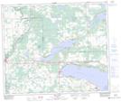
Maps showing Park Court, 34-54-7-W5, Alberta
Park Court is a Unincorporated area located in 34-54-7-W5, Alberta and has an elevation of 744 meters.
- Latitude: 53° 42' 50'' North (decimal: 53.7138888)
- Longitude: 114° 57' 45'' West (decimal: -114.9625000)
- Topography Feature Category: Unincorporated area
- Geographical Feature: Locality
- Canadian Province/Territory: Alberta
- Elevation: 744 meters
- Location: 34-54-7-W5
- Atlas of Canada Locator Map: Park Court
- GPS Coordinate Locator Map: Park Court Lat/Long
Park Court NTS Map Sheets