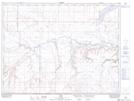
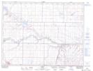
Maps showing Deer Creek, 2-2-12-W4, Alberta
Deer Creek is a River located in 2-2-12-W4, Alberta and has an elevation of 997 meters.
- Latitude: 49° 6' North (decimal: 49.1000000)
- Longitude: 111° 23' West (decimal: -111.3833333)
- Topography Feature Category: River
- Geographical Feature: Creek
- Canadian Province/Territory: Alberta
- Elevation: 997 meters
- Location: 2-2-12-W4
- Atlas of Canada Locator Map: Deer Creek
- GPS Coordinate Locator Map: Deer Creek Lat/Long
Deer Creek NTS Map Sheets