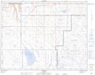
Maps showing Denhart, 2-20-11-W4, Alberta
Denhart is a Unincorporated area located in 2-20-11-W4, Alberta.
- Latitude: 50° 40' 44'' North (decimal: 50.6788888)
- Longitude: 111° 23' 25'' West (decimal: -111.3902778)
- Topography Feature Category: Unincorporated area
- Geographical Feature: Locality
- Canadian Province/Territory: Alberta
- Location: 2-20-11-W4
- Atlas of Canada Locator Map: Denhart
- GPS Coordinate Locator Map: Denhart Lat/Long
Denhart NTS Map Sheets