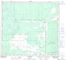
Maps showing Keg River, 21-101-24-W5, Alberta
Keg River is a Unincorporated area located in 21-101-24-W5, Alberta and has an elevation of 426 meters.
- Latitude: 57° 47' 17'' North (decimal: 57.7881758)
- Longitude: 117° 51' 30'' West (decimal: -117.8584033)
- Topography Feature Category: Unincorporated area
- Geographical Feature: Hamlet
- Canadian Province/Territory: Alberta
- Elevation: 426 meters
- Location: 21-101-24-W5
- Atlas of Canada Locator Map: Keg River
- GPS Coordinate Locator Map: Keg River Lat/Long
Keg River NTS Map Sheets