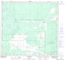
Maps showing Keg River, 23-101-23-W5, Alberta
Keg River is a Unincorporated area located in 23-101-23-W5, Alberta and has an elevation of 407 meters.
- Latitude: 57° 47' 10'' North (decimal: 57.7861111)
- Longitude: 117° 39' 50'' West (decimal: -117.6638889)
- Topography Feature Category: Unincorporated area
- Geographical Feature: Railway Point
- Canadian Province/Territory: Alberta
- Elevation: 407 meters
- Location: 23-101-23-W5
- Atlas of Canada Locator Map: Keg River
- GPS Coordinate Locator Map: Keg River Lat/Long
Keg River NTS Map Sheets