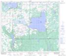
Maps showing Kehiwin Lake, 58,59-7-W4, Alberta
Kehiwin Lake is a Lake located in 58,59-7-W4, Alberta and has an elevation of 552 meters.
- Latitude: 54° 3' 22'' North (decimal: 54.0561111)
- Longitude: 110° 54' 15'' West (decimal: -110.9041667)
- Topography Feature Category: Lake
- Geographical Feature: Lake
- Canadian Province/Territory: Alberta
- Elevation: 552 meters
- Location: 58,59-7-W4
- Atlas of Canada Locator Map: Kehiwin Lake
- GPS Coordinate Locator Map: Kehiwin Lake Lat/Long
Kehiwin Lake NTS Map Sheets