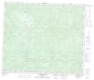
Maps showing Kenny Creek, 62-9-W6, Alberta
Kenny Creek is a River located in 62-9-W6, Alberta and has an elevation of 1343 meters.
- Latitude: 54° 22' 56'' North (decimal: 54.3822222)
- Longitude: 119° 18' 42'' West (decimal: -119.3116667)
- Topography Feature Category: River
- Geographical Feature: Creek
- Canadian Province/Territory: Alberta
- Elevation: 1343 meters
- Location: 62-9-W6
- Atlas of Canada Locator Map: Kenny Creek
- GPS Coordinate Locator Map: Kenny Creek Lat/Long
Kenny Creek NTS Map Sheets