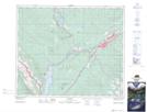
Maps showing Kia Nea Lake, 49-26-W5, Alberta
Kia Nea Lake is a Lake located in 49-26-W5, Alberta and has an elevation of 1148 meters.
- Latitude: 53° 16' 14'' North (decimal: 53.2705555)
- Longitude: 117° 46' 41'' West (decimal: -117.7780556)
- Topography Feature Category: Lake
- Geographical Feature: Lake
- Canadian Province/Territory: Alberta
- Elevation: 1148 meters
- Location: 49-26-W5
- Atlas of Canada Locator Map: Kia Nea Lake
- GPS Coordinate Locator Map: Kia Nea Lake Lat/Long