Canada Topographic Maps

Municipal District of Peace No. 135 Topo Maps

Topography maps and Latitude/Longitude Location

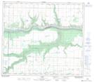
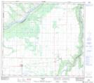
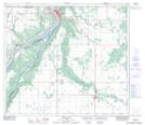
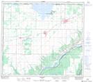
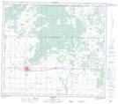
Maps showing Municipal District of Peace No. 135, 82-24-W5, Alberta

Municipal District of Peace No. 135 is a Major municipal/district area - major agglomeration located in 82-24-W5, Alberta.

  • Latitude: 56° 7' 50'' North   (decimal: 56.1306000)
  • Longitude: 117° 45' 8'' West   (decimal: -117.7522000)
  • Topography Feature Category: Major municipal/district area - major agglomeration
  • Geographical Feature: Municipal District
  • Canadian Province/Territory: Alberta
  • Location: 82-24-W5
  • Atlas of Canada Locator Map: Municipal District of Peace No. 135
  • GPS Coordinate Locator Map: Municipal District of Peace No. 135 Lat/Long

Municipal District of Peace No. 135 NTS Map Sheets

083M16 Codesa Topographic Map at 1:50,000 scale

083N13 Tangent Topographic Map at 1:50,000 scale

084C03 Peace River Topographic Map at 1:50,000 scale

084C04 Grimshaw Topographic Map at 1:50,000 scale

084D01 Fairview Topographic Map at 1:50,000 scale

083M Grande Prairie Topographic Map at 1:250,000 scale

083N Winagami Topographic Map at 1:250,000 scale

084C Peace River Topographic Map at 1:250,000 scale

084D Clear Hills Topographic Map at 1:250,000 scale

 
Buy Topographic Maps DVD
Newsletter Sign-up

Yes, I want to receive map store discounts.


Bookmark and Share