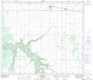
Maps showing Peavine Creek, 21-76-22-W5, Alberta
Peavine Creek is a River located in 21-76-22-W5, Alberta and has an elevation of 500 meters.
- Latitude: 55° 35' 31'' North (decimal: 55.5918999)
- Longitude: 117° 21' 11'' West (decimal: -117.3530999)
- Topography Feature Category: River
- Geographical Feature: Creek
- Canadian Province/Territory: Alberta
- Elevation: 500 meters
- Location: 21-76-22-W5
- Atlas of Canada Locator Map: Peavine Creek
- GPS Coordinate Locator Map: Peavine Creek Lat/Long