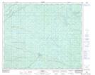
Maps showing Pedley, 3-52-24-W5, Alberta
Pedley is a Unincorporated area located in 3-52-24-W5, Alberta and has an elevation of 1058 meters.
- Latitude: 53° 27' 57'' North (decimal: 53.4658333)
- Longitude: 117° 26' 36'' West (decimal: -117.4433333)
- Topography Feature Category: Unincorporated area
- Geographical Feature: Locality
- Canadian Province/Territory: Alberta
- Elevation: 1058 meters
- Location: 3-52-24-W5
- Atlas of Canada Locator Map: Pedley
- GPS Coordinate Locator Map: Pedley Lat/Long