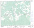
Maps showing Peers, 16-54-14-W5, Alberta
Peers is a Unincorporated area located in 16-54-14-W5, Alberta and has an elevation of 846 meters.
- Latitude: 53° 39' 57'' North (decimal: 53.6658333)
- Longitude: 115° 59' 33'' West (decimal: -115.9925000)
- Topography Feature Category: Unincorporated area
- Geographical Feature: Hamlet
- Canadian Province/Territory: Alberta
- Elevation: 846 meters
- Location: 16-54-14-W5
- Atlas of Canada Locator Map: Peers
- GPS Coordinate Locator Map: Peers Lat/Long
Peers NTS Map Sheets