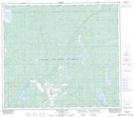
Maps showing Pentland Lake, 78,79-14-W5, Alberta
Pentland Lake is a Lake located in 78,79-14-W5, Alberta and has an elevation of 707 meters.
- Latitude: 55° 48' 46'' North (decimal: 55.8127777)
- Longitude: 116° 2' 52'' West (decimal: -116.0477777)
- Topography Feature Category: Lake
- Geographical Feature: Lake
- Canadian Province/Territory: Alberta
- Elevation: 707 meters
- Location: 78,79-14-W5
- Atlas of Canada Locator Map: Pentland Lake
- GPS Coordinate Locator Map: Pentland Lake Lat/Long
Pentland Lake NTS Map Sheets