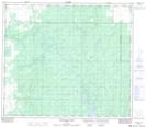
Maps showing Pete Lake, 34-73-25-W5, Alberta
Pete Lake is a Lake located in 34-73-25-W5, Alberta and has an elevation of 695 meters.
- Latitude: 55° 21' 45'' North (decimal: 55.3624999)
- Longitude: 117° 45' 58'' West (decimal: -117.7661110)
- Topography Feature Category: Lake
- Geographical Feature: Lake
- Canadian Province/Territory: Alberta
- Elevation: 695 meters
- Location: 34-73-25-W5
- Atlas of Canada Locator Map: Pete Lake
- GPS Coordinate Locator Map: Pete Lake Lat/Long
Pete Lake NTS Map Sheets