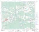
Maps showing Lambert Pond, 12-8-53-17-W5, Alberta
Lambert Pond is a Lake located in 12-8-53-17-W5, Alberta and has an elevation of 920 meters.
- Latitude: 53° 33' 58'' North (decimal: 53.5661111)
- Longitude: 116° 28' 53'' West (decimal: -116.4813888)
- Topography Feature Category: Lake
- Geographical Feature: Pond
- Canadian Province/Territory: Alberta
- Elevation: 920 meters
- Location: 12-8-53-17-W5
- Atlas of Canada Locator Map: Lambert Pond
- GPS Coordinate Locator Map: Lambert Pond Lat/Long