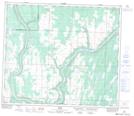
Maps showing Sawdy Creek, 35-67-22-W4, Alberta
Sawdy Creek is a River located in 35-67-22-W4, Alberta and has an elevation of 521 meters.
- Latitude: 54° 50' 39'' North (decimal: 54.8441667)
- Longitude: 113° 14' 32'' West (decimal: -113.2422221)
- Topography Feature Category: River
- Geographical Feature: Creek
- Canadian Province/Territory: Alberta
- Elevation: 521 meters
- Location: 35-67-22-W4
- Atlas of Canada Locator Map: Sawdy Creek
- GPS Coordinate Locator Map: Sawdy Creek Lat/Long