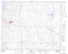
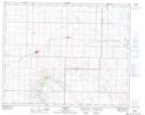
Maps showing Fox Lake, 31-14,15-W4, Alberta
Fox Lake is a Lake located in 31-14,15-W4, Alberta and has an elevation of 821 meters.
- Latitude: 51° 39' 30'' North (decimal: 51.6583333)
- Longitude: 111° 59' 00'' West (decimal: -111.9833333)
- Topography Feature Category: Lake
- Geographical Feature: Lake
- Canadian Province/Territory: Alberta
- Elevation: 821 meters
- Location: 31-14,15-W4
- Atlas of Canada Locator Map: Fox Lake
- GPS Coordinate Locator Map: Fox Lake Lat/Long
Fox Lake NTS Map Sheets