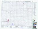
Maps showing Monument Hill, 29-25-23-W4, Alberta
Monument Hill is a Mountain located in 29-25-23-W4, Alberta and has an elevation of 928 meters.
- Latitude: 51° 9' 32'' North (decimal: 51.1588888)
- Longitude: 113° 10' 34'' West (decimal: -113.1761110)
- Topography Feature Category: Mountain
- Geographical Feature: Hill
- Canadian Province/Territory: Alberta
- Elevation: 928 meters
- Location: 29-25-23-W4
- Atlas of Canada Locator Map: Monument Hill
- GPS Coordinate Locator Map: Monument Hill Lat/Long
Monument Hill NTS Map Sheets