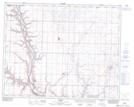
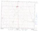
Maps showing Sarcee Butte, 11,12-31-22-W4, Alberta
Sarcee Butte is a Mountain located in 11,12-31-22-W4, Alberta and has an elevation of 874 meters.
- Latitude: 51° 38' 11'' North (decimal: 51.6363888)
- Longitude: 112° 59' 24'' West (decimal: -112.9899999)
- Topography Feature Category: Mountain
- Geographical Feature: Butte
- Canadian Province/Territory: Alberta
- Elevation: 874 meters
- Location: 11,12-31-22-W4
- Atlas of Canada Locator Map: Sarcee Butte
- GPS Coordinate Locator Map: Sarcee Butte Lat/Long
Sarcee Butte NTS Map Sheets