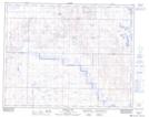
Maps showing Wolf Hill, 24-34-18-W4, Alberta
Wolf Hill is a Mountain located in 24-34-18-W4, Alberta and has an elevation of 852 meters.
- Latitude: 51° 56' 4'' North (decimal: 51.9344444)
- Longitude: 112° 24' 53'' West (decimal: -112.4147222)
- Topography Feature Category: Mountain
- Geographical Feature: Hill
- Canadian Province/Territory: Alberta
- Elevation: 852 meters
- Location: 24-34-18-W4
- Atlas of Canada Locator Map: Wolf Hill
- GPS Coordinate Locator Map: Wolf Hill Lat/Long
Wolf Hill NTS Map Sheets