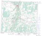
Maps showing Athabasca, 16-66-22-W4, Alberta
Athabasca is a Town located in 16-66-22-W4, Alberta and has an elevation of 522 meters.
- Latitude: 54° 43' 00'' North (decimal: 54.7166666)
- Longitude: 113° 17' 3'' West (decimal: -113.2841667)
- Topography Feature Category: Town
- Geographical Feature: Town
- Canadian Province/Territory: Alberta
- Elevation: 522 meters
- Location: 16-66-22-W4
- Atlas of Canada Locator Map: Athabasca
- GPS Coordinate Locator Map: Athabasca Lat/Long
Athabasca NTS Map Sheets