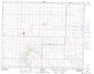
Maps showing Cut-Off Coulee, 15,16-30-17-W4, Alberta
Cut-Off Coulee is a Valley located in 15,16-30-17-W4, Alberta and has an elevation of 1062 meters.
- Latitude: 51° 34' 4'' North (decimal: 51.5677778)
- Longitude: 112° 19' 49'' West (decimal: -112.3302778)
- Topography Feature Category: Valley
- Geographical Feature: Coulee
- Canadian Province/Territory: Alberta
- Elevation: 1062 meters
- Location: 15,16-30-17-W4
- Atlas of Canada Locator Map: Cut-Off Coulee
- GPS Coordinate Locator Map: Cut-Off Coulee Lat/Long
Cut-Off Coulee NTS Map Sheets