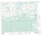
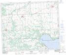
Maps showing Poplar Creek, 20-49-5-W5, Alberta
Poplar Creek is a River located in 20-49-5-W5, Alberta and has an elevation of 915 meters.
- Latitude: 53° 14' 51'' North (decimal: 53.2474999)
- Longitude: 114° 42' 27'' West (decimal: -114.7074999)
- Topography Feature Category: River
- Geographical Feature: Creek
- Canadian Province/Territory: Alberta
- Elevation: 915 meters
- Location: 20-49-5-W5
- Atlas of Canada Locator Map: Poplar Creek
- GPS Coordinate Locator Map: Poplar Creek Lat/Long
Poplar Creek NTS Map Sheets