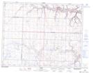
Maps showing Carbon, 15-29-23-W4, Alberta
Carbon is a Village located in 15-29-23-W4, Alberta and has an elevation of 797 meters.
- Latitude: 51° 29' 9'' North (decimal: 51.4858333)
- Longitude: 113° 9' 2'' West (decimal: -113.1505555)
- Topography Feature Category: Village
- Geographical Feature: Village
- Canadian Province/Territory: Alberta
- Elevation: 797 meters
- Location: 15-29-23-W4
- Atlas of Canada Locator Map: Carbon
- GPS Coordinate Locator Map: Carbon Lat/Long