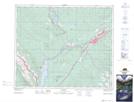
Maps showing Champ de manoeuvre Jarvis Lake, Alberta
Champ de manoeuvre Jarvis Lake is a Military area located in Alberta and has an elevation of 1174 meters.
- Latitude: 53° 27' North (decimal: 53.4499999)
- Longitude: 117° 49' West (decimal: -117.8166999)
- Topography Feature Category: Military area
- Geographical Feature: C.M.F.C.
- Canadian Province/Territory: Alberta
- Elevation: 1174 meters
- Atlas of Canada Locator Map: Champ de manoeuvre Jarvis Lake
- GPS Coordinate Locator Map: Champ de manoeuvre Jarvis Lake Lat/Long