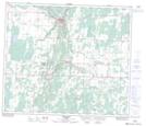
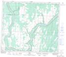
Maps showing Athabasca Landing Provincial Historic Site (Undeveloped), 20-66-22-W4, Alberta
Athabasca Landing Provincial Historic Site (Undeveloped) is a Conservation area located in 20-66-22-W4, Alberta.
- Latitude: 54° 43' North (decimal: 54.7167000)
- Longitude: 113° 17' West (decimal: -113.2833000)
- Topography Feature Category: Conservation area
- Geographical Feature: Provincial Historic Site
- Canadian Province/Territory: Alberta
- Location: 20-66-22-W4
- Atlas of Canada Locator Map: Athabasca Landing Provincial Historic Site (Undeveloped)
- GPS Coordinate Locator Map: Athabasca Landing Provincial Historic Site (Undeveloped) Lat/Long
Athabasca Landing Provincial Historic Site (Undeveloped) NTS Map Sheets