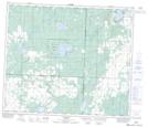
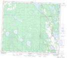
Maps showing West Baptiste, 66,67-24-W4, Alberta
West Baptiste is a Village located in 66,67-24-W4, Alberta and has an elevation of 588 meters.
- Latitude: 54° 45' 45'' North (decimal: 54.7624999)
- Longitude: 113° 34' 2'' West (decimal: -113.5672221)
- Topography Feature Category: Village
- Geographical Feature: Summer Village
- Canadian Province/Territory: Alberta
- Elevation: 588 meters
- Location: 66,67-24-W4
- Atlas of Canada Locator Map: West Baptiste
- GPS Coordinate Locator Map: West Baptiste Lat/Long
West Baptiste NTS Map Sheets