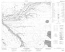
Maps showing Cree Creek, 26-88-6-W4, Alberta
Cree Creek is a River located in 26-88-6-W4, Alberta.
- Latitude: 56° 39' 56'' North (decimal: 56.6655555)
- Longitude: 110° 50' 53'' West (decimal: -110.8480555)
- Topography Feature Category: River
- Geographical Feature: Creek
- Canadian Province/Territory: Alberta
- Location: 26-88-6-W4
- Atlas of Canada Locator Map: Cree Creek
- GPS Coordinate Locator Map: Cree Creek Lat/Long
Cree Creek NTS Map Sheets