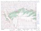
Maps showing Nine Mile Creek, Alberta
Nine Mile Creek is a River located in Alberta and has an elevation of 1302 meters.
- Latitude: 49° 35' 25'' North (decimal: 49.5902999)
- Longitude: 110° 0' 20'' West (decimal: -110.0056000)
- Topography Feature Category: River
- Geographical Feature: Creek
- Canadian Province/Territory: Alberta
- Elevation: 1302 meters
- Atlas of Canada Locator Map: Nine Mile Creek
- GPS Coordinate Locator Map: Nine Mile Creek Lat/Long
Nine Mile Creek NTS Map Sheets