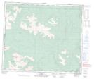
Maps showing Hidden Valley Creek, 20-60-13-W6, Alberta
Hidden Valley Creek is a River located in 20-60-13-W6, Alberta.
- Latitude: 54° 11' 58'' North (decimal: 54.1994444)
- Longitude: 119° 54' 12'' West (decimal: -119.9033332)
- Topography Feature Category: River
- Geographical Feature: Creek
- Canadian Province/Territory: Alberta
- Location: 20-60-13-W6
- Atlas of Canada Locator Map: Hidden Valley Creek
- GPS Coordinate Locator Map: Hidden Valley Creek Lat/Long