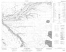
Maps showing Elmer's Creek, 31-88-5-W4, Alberta
Elmer's Creek is a River located in 31-88-5-W4, Alberta.
- Latitude: 56° 40' 53'' North (decimal: 56.6813888)
- Longitude: 110° 48' 13'' West (decimal: -110.8036111)
- Topography Feature Category: River
- Geographical Feature: Creek
- Canadian Province/Territory: Alberta
- Location: 31-88-5-W4
- Atlas of Canada Locator Map: Elmer's Creek
- GPS Coordinate Locator Map: Elmer's Creek Lat/Long
Elmer's Creek NTS Map Sheets