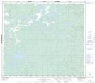
Maps showing Chain Lakes, 83-8-W4, Alberta
Chain Lakes is a Lake located in 83-8-W4, Alberta.
- Latitude: 56° 13' 31'' North (decimal: 56.2252777)
- Longitude: 111° 10' 43'' West (decimal: -111.1786111)
- Topography Feature Category: Lake
- Geographical Feature: Lakes
- Canadian Province/Territory: Alberta
- Location: 83-8-W4
- Atlas of Canada Locator Map: Chain Lakes
- GPS Coordinate Locator Map: Chain Lakes Lat/Long
Chain Lakes NTS Map Sheets