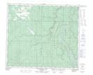
Maps showing McMillar Creek, 30-67-4-W6, Alberta
McMillar Creek is a River located in 30-67-4-W6, Alberta.
- Latitude: 54° 49' 50'' North (decimal: 54.8306000)
- Longitude: 118° 35' 28'' West (decimal: -118.5910999)
- Topography Feature Category: River
- Geographical Feature: Creek
- Canadian Province/Territory: Alberta
- Location: 30-67-4-W6
- Atlas of Canada Locator Map: McMillar Creek
- GPS Coordinate Locator Map: McMillar Creek Lat/Long
McMillar Creek NTS Map Sheets