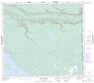
Maps showing Little Rocky Point, 20-87-3-W4, Alberta
Little Rocky Point is a Cape located in 20-87-3-W4, Alberta.
- Latitude: 56° 33' 38'' North (decimal: 56.5605555)
- Longitude: 110° 27' 0'' West (decimal: -110.4500000)
- Topography Feature Category: Cape
- Geographical Feature: Point
- Canadian Province/Territory: Alberta
- Location: 20-87-3-W4
- Atlas of Canada Locator Map: Little Rocky Point
- GPS Coordinate Locator Map: Little Rocky Point Lat/Long
Little Rocky Point NTS Map Sheets