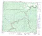
Maps showing Shuttler Flats, 2-67-11-W6, Alberta
Shuttler Flats is a Beach located in 2-67-11-W6, Alberta.
- Latitude: 54° 46' 18'' North (decimal: 54.7716666)
- Longitude: 119° 33' 45'' West (decimal: -119.5625000)
- Topography Feature Category: Beach
- Geographical Feature: Flats
- Canadian Province/Territory: Alberta
- Location: 2-67-11-W6
- Atlas of Canada Locator Map: Shuttler Flats
- GPS Coordinate Locator Map: Shuttler Flats Lat/Long
Shuttler Flats NTS Map Sheets