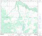
Maps showing New Fish Creek, 6-73-21-W5, Alberta
New Fish Creek is a River located in 6-73-21-W5, Alberta.
- Latitude: 55° 17' 27'' North (decimal: 55.2908332)
- Longitude: 117° 13' 57'' West (decimal: -117.2325000)
- Topography Feature Category: River
- Geographical Feature: Creek
- Canadian Province/Territory: Alberta
- Location: 6-73-21-W5
- Atlas of Canada Locator Map: New Fish Creek
- GPS Coordinate Locator Map: New Fish Creek Lat/Long
New Fish Creek NTS Map Sheets