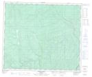
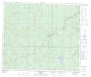
Maps showing Rat Creek, 21-64-6-W6, Alberta
Rat Creek is a River located in 21-64-6-W6, Alberta.
- Latitude: 54° 33' 1'' North (decimal: 54.5502778)
- Longitude: 118° 51' 1'' West (decimal: -118.8502778)
- Topography Feature Category: River
- Geographical Feature: Creek
- Canadian Province/Territory: Alberta
- Location: 21-64-6-W6
- Atlas of Canada Locator Map: Rat Creek
- GPS Coordinate Locator Map: Rat Creek Lat/Long
Rat Creek NTS Map Sheets