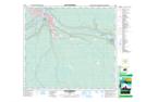
Maps showing Peden's Point, 12-28-89-9-W4, Alberta
Peden's Point is a Cape located in 12-28-89-9-W4, Alberta.
- Latitude: 56° 44' 51'' North (decimal: 56.7475000)
- Longitude: 111° 23' 4'' West (decimal: -111.3844444)
- Topography Feature Category: Cape
- Geographical Feature: Point
- Canadian Province/Territory: Alberta
- Location: 12-28-89-9-W4
- Atlas of Canada Locator Map: Peden's Point
- GPS Coordinate Locator Map: Peden's Point Lat/Long
Peden's Point NTS Map Sheets