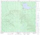
Maps showing Mystery Lake, 8-33-85-7-W4, Alberta
Mystery Lake is a Lake located in 8-33-85-7-W4, Alberta.
- Latitude: 56° 24' 46'' North (decimal: 56.4127777)
- Longitude: 111° 2' 8'' West (decimal: -111.0355555)
- Topography Feature Category: Lake
- Geographical Feature: Lake
- Canadian Province/Territory: Alberta
- Location: 8-33-85-7-W4
- Atlas of Canada Locator Map: Mystery Lake
- GPS Coordinate Locator Map: Mystery Lake Lat/Long
Mystery Lake NTS Map Sheets