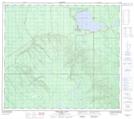
Maps showing Island Lake, SW-21-84-8-W4, Alberta
Island Lake is a Lake located in SW-21-84-8-W4, Alberta.
- Latitude: 56° 17' 18'' North (decimal: 56.2883333)
- Longitude: 111° 12' 46'' West (decimal: -111.2127777)
- Topography Feature Category: Lake
- Geographical Feature: Lake
- Canadian Province/Territory: Alberta
- Location: SW-21-84-8-W4
- Atlas of Canada Locator Map: Island Lake
- GPS Coordinate Locator Map: Island Lake Lat/Long
Island Lake NTS Map Sheets